Explore the natural beauty of Ireland with these 10 easy, family-friendly hikes in the Dublin and Wicklow Mountains. Each trail offers a gentle adventure suitable for beginners or families, with low elevation gains and manageable distances. We’ve included practical details for each hike – like trailhead locations, distances, duration, difficulty, and seasonal tips – so you can plan your outing confidently. Whether you’re a local seeking a weekend escape or an international visitor looking to experience Ireland’s great outdoors, these hikes offer stunning scenery without strenuous effort. Lace up your walking shoes and get ready to discover rolling hills, serene lakes, ancient ruins, and panoramic vistas just a stone’s throw from Dublin City!
- Top 10 Easy Hikes at a Glance
Our selection ranges from forested hill walks in the Dublin Mountains to lakeside strolls in Wicklow. All hikes are under 8 km and generally take 2 hours or less, making them perfect half-day trips. Each trail promises rewarding views without extreme climbs. - Family & Beginner Friendly
These trails are suitable for beginners and families — expect well-marked paths and gentle gradients. Several are even buggy (stroller) friendly or wheelchair accessible (like parts of Glendalough’s Green Road and Blessington Greenway). Always supervise children on any heights or near water. - When to Go & What to Expect
Most hikes can be enjoyed year-round but spring and autumn offer mild weather and beautiful colors. Summer brings longer daylight (perfect for Bray Cliff Walk’s coastal views), while winter may have muddy sections (Knocksink Wood can get mucky in wet weather). Dress in layers, wear sturdy shoes and always carry rain gear — this is Ireland after all!
Before diving into the detailed descriptions, here’s a summary table of the 10 hikes with key information and image sources for quick reference:
| Name | Location | Distance | Duration | Difficulty |
| Hellfire Club (Montpelier Hill) | Dublin Mountains (Rathfarnham) | 4.2 km loop | ~1-1.5 hours | Easy/Moderate |
| Ticknock Fairy Castle Loop | Dublin Mountains (Sandyford) | 5.5-6 km loop | ~1.5-2 hours | Moderate (steady climb) |
| Bohernabreena Reservoir Loop | Dublin Mountains (Glenasmole) | 4 km or 8.5 km | 1-1.5 hours (short); ~2 hours (long) | Easy (flat path) |
| Great Sugarloaf | Wicklow (Kilmacanogue) | ~2.5 km | ~1 hour | Easy/Moderate (short but steep) |
| Bray to Greystones Cliff Walk | Wicklow Coast (Bray – Greystones) | ~7 km one way | ~2 hours one way | Easy/Moderate |
| Bray Head (Summit trail) | Wicklow (Bray Head) | ~3 km round trip | ~1 hour | Easy/Moderate (short climb) |
| Glendalough Green Road | Wicklow Mountains National Park | 3 km loop | ~1 hour | Easy (flat, boardwalk) |
| Devil’s Glen (Waterfall walk) | Wicklow (Ashford) | 5 km loop | ~2-2.5 hours | Easy (woodland trail) |
| Blessington Greenway | Wicklow (Blessington) | 6.5 km one way | ~1.5 hours one way | Easy/Moderate |
| Avondale Forest Park Trails | Wicklow (Rathdrum) | 2-4 km | ~30 min -1 hour | Easy/Moderate |
1. Hellfire Club (Montpelier Hill, Dublin Mountains)
Location: Montpelier Hill, south County Dublin (Rathfarnham/Firhouse area). Trailhead at Hellfire Club car park off R115 (Mountpelier Road)
Distance & Duration: ~4.2 km loop, 1 to 1.5 hours at a leisurely pace.
Difficulty: Easy to moderate. A short uphill hike with a fair incline at the start, but very doable for anyone of moderate fitness. The main trail (Montpelier Loop) is well-marked (follow the blue waymarkers).
Elevation: Trail climbs to ~383 m at Montpelier Hill’s summit – the highest point of the hike. The initial ascent is the steepest section, after which the path levels out.
Highlights: Historic ruins & panoramic city views. At the summit stands the ruined Hellfire Club lodge, an 18th-century stone hunting lodge with a notorious past (local legends of wild parties and occult rituals make for great storytelling). Feel free to carefully explore the two-story ruin – it’s open and you can peek inside (mind your step on the stone floors). From the top, enjoy breathtaking panoramic views north over Dublin City and its bay, and south over the Glenasmole Valley and Wicklow Mountains. On clear days you can see as far as the Dublin city skyline and the Irish Sea. There are also interesting prehistoric features (the site was originally a passage tomb cairn) adding a bit of mythic atmosphere.
Trail Description: Starting at the Hellfire Club car park, the trail winds gradually uphill through a pine forest on Montpelier Hill. After about 10–15 minutes, you’ll reach a junction: a steep gravel shortcut branches right to the summit (a quick but steep 10-minute climb), while the loop trail continues straight, offering a gentler ascent around the hill. We recommend doing the full loop: it’s a moderate climb but less intense than the shortcut, and it wraps around the hill through the woods, revealing lovely views of Glenasmole Valley on the way up. As you emerge from the trees near the top, the Hellfire Lodge ruin comes into view. After exploring the summit, descend on the far side of the lodge to complete the loop – this section is a steep, uneven downhill back into the forest that returns you to the car park. Take care here, especially in wet conditions – the gravel can be slippery.
Amenities: The car park (managed by Coillte) is open 7am–9pm in summer, 8am–5pm in winter. A coffee truck often operates at the car park on weekends in summer, selling drinks and ice cream – a nice treat post-hike. Note: The car park fills quickly on weekends, so arrive early to secure a spot. There are no toilets on-site. Public transport is tricky (no direct bus to trailhead; the nearest stop still requires a taxi or very long walk), so driving or taking a guided tour is recommended.
Seasonal Tips: Open year-round. This trail is popular in all seasons. It’s especially beautiful on clear mornings or at sunset, when the light over Dublin is magical (as implied by the famous “dawn” photo of Hellfire Club). In autumn, the forested section glows with golden foliage. In winter or after heavy rains, the trail can be muddy – waterproof boots are a good idea, and consider the shortcut path only if conditions are dry (it can be slippery when wet). The exposed summit can be windy, so bring an extra layer. Families often hike here; older kids love exploring the ‘haunted’ ruin, but keep an eye on younger children on the steep parts and near the open ruin windows.
2. Ticknock – Fairy Castle Loop (Dublin Mountains)
Location: Ticknock Forest, Dublin Mountains, about 10 km south of Dublin City. Trail begins at Ticknock Forest Recreation Area (Ticknock car park), accessible via Sandyford (follow signs toward Three Rock Mountain/Ticknock).
Distance & Duration: ~6 km loop, roughly 1.5 to 1.75 hours to complete. (Some fit hikers do it in 1.25 hours, but plan for a relaxed 1.5–2 hours to enjoy the scenery.)
Difficulty: Moderate. It’s an easy-to-follow trail with steady uphill sections – suitable for active beginners or families with older kids. Elevation gain is about 210–220 m. The path is a mix of forest roads (gravel) and rocky mountain trail. After rain, certain parts can be a bit muddy or slippery, but nothing too technically challenging.
Highlights: City panoramas, forests, and a mountaintop tomb. Ticknock offers phenomenal views of Dublin Bay and city from the slopes of Three Rock Mountain. Early in the hike you’ll pass the iconic Three Rock formations – huge granite outcrops perched on the hillside. These make a great rest stop to snap photos of the vista: on a clear day you’ll see Dublin city sprawled below and the Irish Sea beyond. The loop’s high point is Fairy Castle, which is not an actual castle but a prehistoric passage tomb mound (it looks like a big cairn). At 537 m elevation, Fairy Castle is the highest point in the Dublin Mountains and yields 360° views – north over Dublin and south deeper into Wicklow. The summit’s open heather moorland feels wonderfully remote despite being so close to the city. Along the way, you’ll also enjoy peaceful stretches through pine and spruce forest (Ticknock Forest) and likely spot mountain bikers (Ticknock is a popular biking area, though they use separate trails for the most part).
Trail Description: Starting from the car park, head uphill along the broad forest track. Follow signs for the “Fairy Castle Loop” (marked by trail posts, often green). The trail climbs gradually through the forest. After about 20–30 minutes, you’ll reach open hillside near the Three Rock viewpoint – three distinctive rocks where the trees clear. From here, continue uphill toward Fairy Castle. The path becomes narrower and rockier as you approach the summit cairn (a short spur path leads to the very top). After taking in the view at Fairy Castle’s summit, the loop trail bends left and descends back toward the forest, eventually rejoining the main forest road which leads you back to the car park. Throughout the loop, trail junctions are signposted (look for “Loop” arrows). It’s a popular trail, so you’re likely to encounter other hikers.
Amenities: Ticknock car park is free but not large; it can fill up on weekends. No toilets or cafes at the trailhead, but a short drive away in Sandyford/Stepaside you’ll find options. Tip: some hikers stop at the Blue Light Pub on the way back down the hill for refreshment with a view.
Seasonal Tips: Great year-round. In summer, the mountaintop is covered in purple heather blooms. On a clear winter day, the air is crisp and views can stretch for miles, but it can be cold and windy at Fairy Castle – pack a windbreaker. If hiking on a foggy day, be cautious on the open sections as visibility can drop (though the trail is marked, it’s always wise to have a map or our directions handy). Ticknock’s trails can be muddy in winter/spring; waterproof footwear is advised. Families have done this hike with children – the forest part is fun for kids, though the full 6 km might tire out the very young. You can shorten the hike by turning back at Three Rock if needed.
3. Bohernabreena Reservoir Loop (Glenasmole Valley, Dublin Mountains)
Location: Glenasmole Valley, South Dublin County. Trailhead at Bohernabreena Reservoir north car park (off the R114 road about 3.5 km south of Tallaght). Glenasmole is the valley immediately south of Dublin’s Tallaght suburb, at the foot of the Wicklow Mountains.
Distance & Duration: Two main options: a short lower-reservoir loop ~4 km (1 to 1.5 hours), or a longer figure-eight loop ~8.5 km including both upper and lower reservoirs (about 2 hours) [3]. Family tip: Most people opt for the shorter 4 km loop which is flatter and more scenic throughout.
Difficulty: Easy. The path is mostly flat and on good surface (gravel and compacted earth). Elevation gain is minimal – just ~100 m if doing the long loop. Suitable for all fitness levels; even young kids (or strollers, with some effort) can handle the lower loop since it’s an old service road along the water.
Highlights: Lakes, mountain views, and tranquil nature. Bohernabreena consists of two connected reservoirs (upper and lower) set in a peaceful valley that feels worlds away from the nearby city. The lower reservoir loop offers gorgeous views of still water reflecting the surrounding hills and forest. You’ll walk right along the lakeshore, sometimes under a canopy of trees and sometimes out in the open with sheep pastures on the hillside. The Upper Reservoir is a touch more wild – if you do the longer loop, you’ll see an impressive overflow waterfall and perhaps spot waterfowl. Glenasmole is also rich in history: look for the ruins of St. Anne’s church along the trail, and know that the valley is linked to the ancient legend of Oisín and Tír na nÓg. The area is a designated conservation area, so keep an eye out for rare plants or even deer. Overall, the vibe here is serene and scenic – perfect for a quiet walk.
Trail Description: Start at the North car park (note: limited space, arrive early). For the short 4 km loop: from the car park, enter through the gate and follow the path clockwise around the Lower Reservoir. The path hugs the water’s edge, offering continuous views of the lake. At the far end of the lower reservoir, you’ll cross a footbridge or small dam area leading you to the other side of the water, then loop back along the opposite shore. This returns you to the starting point completing a circle around the lower lake. For the 8.5 km route: you’ll continue beyond the lower lake up a narrow country lane to reach the Upper Reservoir – then circle the upper lake and come back down, also finishing via the lower lake loop. The longer trail forms a figure-eight shape and takes a bit more time; it’s also less traveled and has a less interesting initial stretch (a long straight road). Many hikers, including beginners, prefer sticking to the Lower Reservoir circuit for a shorter, more relaxed outing. The paths are straightforward (literally – just follow the shoreline). One important note: use the second entrance from the paid car park if you park there, and go clockwise around the lower lake to avoid confusion at unmarked forks.
Amenities: As of recently, a new paid car park has opened slightly further down the road (with a €5 fee) providing secure parking, toilets, and even a little coffee stand on weekends. This new lot is recommended as it also places you directly on the trail for the loop without the road-walk start. No shops on the trail itself, but the coffee stand (“Goughie’s”) at the car park (weekends) is convenient. Tallaght is only a 10-minute drive if you need restaurants or facilities after your hike.
Seasonal Tips: Year-round enjoyment. Summer brings lush greenery and wildflowers along the path. Autumn turns the valley golden with leaves reflecting in the water – arguably the most beautiful time here. Winter hikers will find it quiet and often misty; the paths remain accessible but can be icy in cold snaps, so tread carefully. The reservoirs attract birdlife seasonally, so bring binoculars if you’re a bird watcher. Weekends can see local walkers, but it’s usually uncrowded compared to other Dublin hikes. The trail is fine in light rain, though views of surrounding mountains (like Kippure in the distance) are best on clear days. If it has rained heavily, parts of the path may have puddles or muddy patches; waterproof shoes help but aren’t absolutely required due to the good gravel surface. Dogs are allowed on leads – they’ll enjoy the walk too just don’t let them jump in the drinking-water reservoir!
4. Great Sugarloaf (County Wicklow)
Location: Near Kilmacanogue, North County Wicklow – about 20 km south of Dublin. The hike starts at the Great Sugarloaf southern trailhead (Red Lane car park) off the R755 (easily accessible from the N11 highway).
Distance & Duration: Approximately 2.5 to 3 km round-trip (if starting from the closest car park), typically 1 to 1.5 hours total. The hike is basically an up-and-down summit walk.
Difficulty: Easy to Moderate. It’s a short hike but includes a steep climb near the summit. The lower half is an easy hill walk on a rough path, but the final approach involves a brief rocky scramble (using hands for balance) up bare rock to reach the peak. Not technically difficult, but it can be a bit challenging for very young kids or those with fear of heights. Overall, many families do climb Sugarloaf – just be prepared for a little huffing and puffing on the steep parts and wear good shoes with grip.
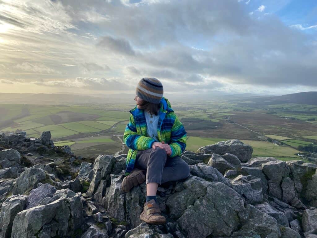
Highlights: 360° summit views of Wicklow and Dublin. The Great Sugarloaf is one of the most recognizable mountains in Ireland – a dramatic cone-shaped hill that stands apart from the main range. Reaching the pointed summit (501 m) rewards you with incredible panoramic views: to the north, the skyline of Dublin and the Irish Sea; to the east, the Bray Head and coastline; south into the Wicklow Mountains; and west, the rolling countryside. On a clear day you can even spot the Welsh mountains across the sea. The sense of accomplishment and the scenery from the top far exceed what you’d expect from a 30–45 minute ascent! The mountain’s volcanic appearance and the crisscrossing eroded trails give it an adventurous feel. Kids often love scrambling on the rocks near the top, and it’s a popular spot to take a summit photo with the view.
Trail Description: From the car park on Red Lane, follow the obvious stony path heading up the slope. The first section is a moderate incline through heather and gorse. After about 15–20 minutes, you reach a flatter shoulder (false summit) where the path turns and you see the final cone above you. The last 10-minute push is much steeper and crosses bare, gravelly ground – multiple little paths braid up the cone; pick one and climb carefully. Use your hands for balance as needed – there are lots of stable rocks. As you crest the summit, be prepared for a bit of wind. The top is a small area of rocks – take in the view and maybe enjoy a snack. Descend carefully the way you came, especially on the upper rocky section (going down can feel slipperier – take your time and maybe slide on your backside for stability on a few bits). The entire route is out-and-back on the same trail. It’s short, so there’s no risk of getting lost as long as you return the same way. Note: There is also a longer northern approach starting near Kilmacanogue, but the described southern route is the easiest and most direct for beginners.
Amenities: The parking at Red Lane is just a roadside pull-off – free but can be busy on weekends. Arrive early to get a spot; if full, attendants sometimes guide cars to overflow areas on busy days. No facilities (toilets/water) on site. The nearest town is Kilmacanogue (2 km) – there you’ll find the famous Avoca Handweavers cafe and shop (great for coffee, lunch, or treats after your hike). Also nearby in Kilmacanogue is a petrol station with a convenience store.
Seasonal Tips: Open year-round. Sunset or sunrise hikes on Sugarloaf are popular due to the unobstructed views – just bring a torch for the descent if it’s getting dark. In summer, start early or late in the day to avoid the midday heat (there’s no shade on the mountain) and to enjoy quieter trails. Winter can be chilly at the summit and occasionally the rocks might have a touch of frost or ice – in such cases, assess carefully if it’s safe to do the final scramble. On very windy days, be extra cautious at the top (the wind can be strong enough to knock you off balance). Because of the potential scramble, very heavy rain can make the summit rocks slick; it might be wise to turn back at the false summit if conditions are poor. But on a typical day, this is a quick, rewarding climb that’s doable even if you only have an hour to spare. Photographers will love the golden hour lighting on the landscape.
5. Bray to Greystones Cliff Walk (Coastal Wicklow)
Location: Coastal path between Bray and Greystones, County Wicklow. You can start in Bray (just south of Bray Beach, near Bray Harbour) or in Greystones (at Greystones Harbour) – the trail runs between the two towns along the coastline. Many start at Bray for a slight downhill grade and convenient return by DART train.
Distance & Duration: ~7 km one-way. Typically 2 to 2.5 hours at a relaxed pace (one direction). If you go out-and-back it’s ~14 km (4–5 hours), but most hikers just do one-way and take the train back (~30 min ride).
Difficulty: Easy. The trail is relatively flat with only gentle undulations – it’s actually an old railway maintenance path, so the grade is mild. Suitable for all ages; we’ve seen everyone from kids in carriers to active seniors enjoying this walk. The path is mostly gravel and earth, wide enough in many places but does narrow on some ledge sections (nothing extreme – just be cautious with children, as there are unfenced cliff edges on the seaward side).
Highlights: Dramatic sea cliffs and coastal scenery. This is one of Wicklow’s most popular walks for good reason: you get constant views of the Irish Sea on one side and the rugged Bray Head cliff face on the other. Starting from Bray, the trail quickly rises a bit above the rocky shoreline, running along cliffs that give a spectacular vantage of the waves crashing below and the curve of Bray Bay behind you. Partway, look for the Bray Head cross above you on the hill (that’s another hike, see Bray Head Summit below). The geology is interesting – you’ll pass through cuttings and see the train tracks intermittently (the DART line tunnels through the headlands). In spring and summer, the gorse and wildflowers bloom bright yellow and purple along the path. Keep an eye out for seabirds soaring on the updrafts – and occasionally dolphins or seals offshore! As you approach Greystones, you’ll see the charming seaside town ahead. Greystones has a beautiful marina and plenty of cafes; finishing the walk with ice cream or fish & chips in Greystones is a treat. Another highlight: transport convenience – since there’s a DART station at each end, you can easily return to your start point without retracing your steps.
Trail Description: Starting at Bray Promenade, walk south past Bray’s aquarium and onto the cliff trail. The path initially ascends slightly and then levels out, carving into the hillside above the sea. Simply follow the well-trodden path southwards – it’s impossible to get lost as it hugs the coastline and is the only path. Mile markers or distance signs aren’t prominent, but you can gauge progress by the views: at about halfway, you’ll round Bray Head and start heading more southwest toward Greystones (you might notice the Greystones harbor in the distance). The terrain alternates between open cliffs and patches of brush. At one dramatic point, the path is a ledge with steep drops (stay inner side if heights concern you, though it’s quite safe if you stay on the trail). Eventually, the trail descends gently into Greystones, emerging by the marina. Trail condition note: There was a landslide on the Greystones end that at times has caused partial closures. As of early 2025, a section near Greystones had temporary fencing and detour signs – check local updates. Usually, if one end is closed, people just do an out-and-back from the other side up to the closure point. Assuming it’s open, continue right into Greystones town.
Amenities: Public transport: Both Bray and Greystones are served by the DART commuter train (as well as buses), making it super easy to access the hike. If you drive, you can park in Bray (street or paid parking lots) and take the train back from Greystones, or vice versa. In Bray, there are toilets and many eateries at the promenade. Along the cliff walk itself, there are no facilities (no bins either – leave no trace and carry your rubbish). In Greystones, you’ll find public toilets near the beach and numerous cafes, pubs, and the famous “Happy Pear” health-food café. The DART runs frequently (approx every 30 minutes mid-day) to return you to Bray or Dublin.
Seasonal Tips: Accessible year-round. This coastal path is excellent in summer, with a sea breeze keeping you cool and longer daylight for an evening stroll. On a sunny day, bring a hat or sunscreen as there’s little shade. In winter or rough weather, be prepared for strong winds on the exposed sections – a waterproof jacket is a must if rain is forecast. The trail can be muddy in spots after rain, but generally stays in good condition. If walking in winter, check that daylight will last or start from Greystones earlier, as there’s no lighting on the path after dark. Families: This is a beloved family outing; just supervise children along the cliff parts and be ready for the distance (perhaps plan a fun stop at Bray’s playground or reward with treats in Greystones). Also, due to the linear nature, ensure little ones can manage ~7 km or arrange a pick-up at the far end.
6. Bray Head Summit (Bray Head Cross Trail)
Location: Bray, on the south end of Bray Beach (County Wicklow). Trail begins near Bray’s southernmost car park (close to Raheen Park). This hike is basically up to the Bray Head Cross and back down, rather than along the cliffs. (It’s a separate but adjacent experience to the Cliff Walk).
Distance & Duration: ~2.5–3 km round-trip, about 1 hour total (add time if you linger). It’s shorter than the cliff walk, but steeper.
Difficulty: Easy to moderate. It’s a short steep climb to the summit (241 m elevation). The path is a mix of steps, dirt, and some rocky slope. Most people with basic fitness can do it – you might just pause to catch your breath on the way up. After rains, parts can be slippery, but plenty of people manage in regular runners. Children can handle it with supervision; the reward at the top is fun for them.\ Highlights: Iconic hilltop cross and commanding coastal views. Bray Head offers a sweeping view over Bray town, the long arc of Bray’s seafront, and the coastline south to Greystones. At the summit stands a large concrete cross, erected in 1950, which has become a symbol of Bray Head. On a clear day, you can see Dublin’s distant northern coastline and mountains to the west. The summit is often breezy and alive with the sounds of seabirds. It’s a fantastic spot for photos, especially looking north where Bray’s esplanade and beach stretch out below. If you’ve also done (or plan to do) the Cliff Walk (#5 above), climbing Bray Head gives you a bird’s-eye perspective of that trail from above. In the spring, the hill is dotted with flowering gorse. This short hike is very popular on weekends with locals and day-trippers.
Trail Description: From Bray’s promenade, locate the well-signed Bray Head trail (follow Quinsboro Road or put “Bray Head car park” in GPS). The trail starts as a lane and quickly becomes a clear path up through woodlands at the base of Bray Head. You’ll climb a series of earthen steps and zigzag upward. There are a few trail splits, but generally all lead uphill – keep an eye out for the most trodden route or any arrow markers. As you near the top, the trees thin out and you emerge onto rocky grassland. Follow the path to the Cross at the summit. There, enjoy the view! You can return down the same way you came (most straightforward).
Optional loop/extension: Some hikers make a loop by descending a different path that veers east and rejoins the base trail near the start – but if unsure, just go back the way you ascended. The main round-trip is short and sweet.
Amenities: Bray town has everything you’d need – parking (fee in summer on the esplanade), toilets, food, etc. The base of the Bray Head hike itself doesn’t have facilities. Once done, you’re right at Bray’s bustling seafront, with cafes, restaurants, and even carnival rides/games in summer. Kids love finishing a hike and then hitting the beach or playground. Also, the DART train stops in Bray, so you can reach here easily from Dublin without a car.
Seasonal Tips: A great fair-weather hike. Sunrise from Bray Head is spectacular (the sun coming up over the sea) – if you’re an early bird, it’s worth it. The trail can get muddy after rain, so boots are better than flip-flops. In summer, mid-day can be hot as the hillside is exposed; bring water. Winter months sometimes bring gusty winds at the top, but if dressed warmly, the short climb will heat you up. Bray Head is known for its Halloween Cross lighting – locals hike up in late October when the cross is illuminated. If combining with the Cliff Walk: doing the cross first (for the workout) then continuing along the Cliff Walk to Greystones is a full day but very fulfilling.
7. Glendalough Green Road Walk (Wicklow Mountains National Park)
Location: Glendalough Valley, Co. Wicklow – about 50 km south of Dublin. Trail starts near the Upper Lake parking area or visitor centre at Glendalough. (Glendalough is well-signposted off the R757 from Laragh village.)
Distance & Duration: ~3 km loop, 45 minutes to 1 hour. Very leisurely, with options to extend to other trails if desired.
Difficulty: Easy. Almost completely flat, on well-maintained wide paths and boardwalks. It’s buggy and wheelchair accessible for much of its length. This is one of the gentlest walks in the national park – perfect for all ages and fitness levels.
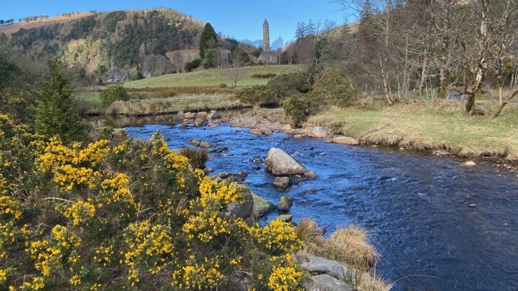
Highlights: Scenic lakeshore and ancient monastic ruins. Glendalough is famous for its two lakes in a glacier-carved valley and its medieval monastic city ruins, so even this easy walk is rich with scenery and history. The Green Road route takes you past the Lower Lake shore with lovely views across the water, through native oak woods, and along a wetland boardwalk teeming with birdlife. You’ll glimpse the round tower and ruins of St. Kevin’s Monastery (founded in the 6th century) near the start/end of the trail. Interpretive signposts give insight into the wildlife and history. This peaceful stroll is especially beautiful in the early morning or late afternoon when crowds thin and the lake surface is calm—reflections of the surrounding mountains (like Camaderry) create picture-perfect moments. Wildlife: you might see deer or the resident feral goats on the valley sides, and ducks or swans on the lake. The Lower Lake wetlands are a unique habitat – listen for frogs and watch for dragonflies in summer.
Trail Description: From the Visitor Centre or main car park, follow the signs for the “Green Road” or “Lower Lake Walk.” The trail is a loop that often gets done in a figure-eight with the boardwalk. Starting clockwise (recommended): head toward the Lower Lake along a wide gravel path, passing through the monastic site area (worth a short detour to see the round tower up close). Continue straight as the path enters a woodland skirting the lake. Soon you’ll reach a long stretch of boardwalk that carries you over the wetland on the lake’s edge [6]. This boardwalk section has lovely lake views and is where you might need to yield for strollers or wheelchairs (it’s sufficiently wide). After the boardwalk, you link back to solid ground on the far side of the Lower Lake. The return leg goes slightly away from the lake through mixed forest on a dirt track. It eventually brings you out by the Upper Lake car park/picnic area. From there, you can either walk the short distance on the Green Road back to where you started, or explore further up to the Upper Lake (another 0.5 km one-way to the Upper Lake beach). Many people combine the Green Road with a stroll to the Upper Lake shore (where there’s a stunning amphitheater-like view of the valley surrounded by mountains). But officially, the Green Road itself loops mainly around the Lower Lake. Navigation is a non-issue – the trails are clearly marked, and trail maps are available at the visitor center.
Amenities: Visitor Centre at Glendalough (near the monastic site) has toilets, maps, and a small exhibition. There’s a seasonal coffee/snack truck at the Upper Lake car park and sometimes near the visitor center as well. Picnic tables are available by the Upper Lake. Parking can be a challenge on weekends/holidays – there are multiple car parks (some free, some paid). It’s best to arrive early in peak season. Public transport: St. Kevin’s Bus runs from Dublin to Glendalough daily, a great option for tourists without cars.
Seasonal Tips: Glendalough is wonderful year-round. Spring brings fresh green foliage and bluebells in the woods. Autumn colours are magnificent, with golden birch and rusty oak leaves reflecting on the water. Summer is busiest – weekdays or early/late in the day are quieter. Even in winter, the Green Road is accessible (unless rare heavy snowfall). Parts of the boardwalk can flood slightly after prolonged rain, but typically it’s fine; just wear boots if it’s been very wet. Because this is a popular destination, you’ll likely encounter other walkers, but the path rarely feels overcrowded due to its breadth. If you want to extend the hike: from the Upper Lake, trails continue to Poulanass Waterfall or the Miners’ Road along the Upper Lake (still relatively flat). These extensions can add 1–3 km more. But as a short loop, the Green Road is ideal for those who want maximum beauty for minimal effort.
8. Devil’s Glen Woodland Walk (Waterfall Trail, Wicklow)
Location: Devil’s Glen Forest, near Ashford, Co. Wicklow (about 15 km east of Glendalough, or 45 km south of Dublin). Trailhead at Devil’s Glen Forest Recreation Area – from Ashford, small local roads lead to the forest entrance (well signposted for Devil’s Glen).
Distance & Duration: Two loop options: the Waterfall Walk ~5 km (about 2 to 2.5 hours) and the Seamus Heaney “Poetry” Walk ~4 km (about 1.5–2 hours). Both loop through the glen; the Waterfall route is slightly longer and more popular for scenery.
Difficulty: Easy-Moderate. The trails are unpaved forest paths with some short steep inclines and declines. Generally suitable for most people with basic fitness – just expect a couple of hill sections that might raise your heart rate. The ground can be uneven (tree roots, rocks) but nothing technical. Families often walk here; children enjoy the woods and waterfall, though be mindful on muddy parts.
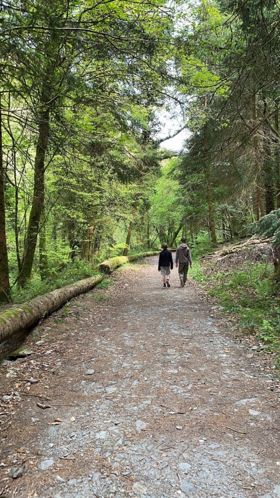
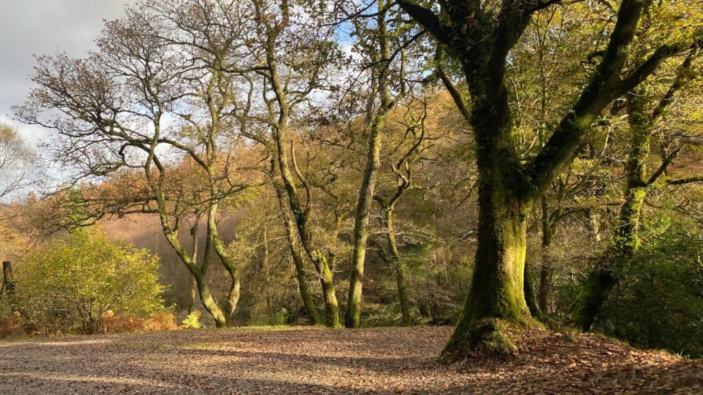
Highlights: Enchanting forest and hidden waterfall. Devil’s Glen is a secluded river valley cut by the River Vartry, and walking here feels like stepping into a tranquil green cathedral of trees. Tall sequoias and firs tower above, remnants of old estate plantings. The trail leads to a viewing point for the Devil’s Glen Waterfall, where the Vartry plunges in a roar (especially after rain). The waterfall is a key highlight – you’ll hear it before you see it, and a side spur leads to a platform for a great look at the cascade as it crashes into the gorge. Along the way, you’ll also find art installations and poetry plaques (the “Seamus Heaney Walk” features verses by the late Nobel-winning Irish poet, who had connections to this area). The combination of art, nature, and history (the glen was once part of an estate) makes this more than just a walk – it’s an immersive cultural-nature experience. Wildlife: keep an eye out for woodland birds and maybe a shy fox or deer. The forest floor is lush with ferns and bluebells in spring. Devil’s Glen tends to be quieter than Glendalough, offering more solitude.
Trail Description: From the car park, enter the forest and follow the clearly marked loop trail signs. The path descends into the glen, eventually running alongside the River Vartry. The sound of the river guides you deeper under the canopy. Follow the “Waterfall Walk” markers (usually a specific color arrow) which will branch to take you to the waterfall viewpoint spur – don’t miss this, it’s the highlight! There might be a short steep climb to actually reach the viewing area. After enjoying the falls, continue on the loop which will bring you back via a different route – there may be an uphill stretch through pines as you climb out of the glen. Eventually, the trail loops back toward the entrance. The Poetry/Seamus Heaney Trail largely overlaps but focuses on interpretive points where you can stop and read poetry on sculpted plaques in the woods. Both loops are well signposted and intersect; maps at trailhead show the routes. Total elevation change is modest (~100 m). The terrain underfoot ranges from packed earth to some rocky patches. If it’s been wet, expect muddy spots, especially near the river.
Amenities: There is a small car park at Devil’s Glen (free). No toilets or shops at the trail – this is a simple forest site. The nearest facilities are in Ashford village (about 5 km), where you’ll find cafes, toilets (in public establishments), and the famous Mount Usher Gardens (if you’re combining visits). Ashford also has a bus connection to Dublin.
Seasonal Tips: Best in late spring through autumn. In spring, Devil’s Glen is magical with wildflowers and the waterfall in full spate from winter rains. Summer offers cool shade in the heat, making it a great retreat (plus, combination of trees and river keeps things lush). Autumn brings beautiful foliage colors to the mix of deciduous and conifer trees. In winter, the trail is still accessible but wear good boots – it can be quite muddy and slippery with fallen leaves and rain, and parts of the path by the river could be waterlogged. Also, be mindful that daylight in winter fades early in a deep glen; start your hike by early afternoon to be safe. Because it’s forested, even a drizzly day can be enjoyable under tree cover, but during or after heavy rain the waterfall area might have minor spray. If visiting after storms, check locally that the trail is clear of fallen branches.
9. Blessington Greenway (Lakeside Walk, West Wicklow)
Location: Blessington Lakes, stretching from Blessington Town to Russborough House in County Wicklow (on the border with Co. Kildare). The Blessington Greenway trail connects these points along the shoreline of the Poulaphouca Reservoir (Blessington Lake). Start at either Blessington town (Lake Shore car park) or at Russborough House (large estate car park) – the trail runs between them.
Distance & Duration: ~6.5 km one-way, about 1.5 hours each way (3 hours return if you do the full out-and-back). Many choose to do sections or arrange a pickup at the far end.
Difficulty:Easy. The Greenway is flat for almost its entire length. The surface is a mix of forest track, gravel, and some tarmac near town – suitable for walkers of all levels, children, and also cyclists. It’s marketed as multi-access and even parts are accessible to bicycles and sturdy strollers, although a few kissing gates make it tricky for wheelchairs. No steep sections at all.
Highlights:Lakeside views, historic estate, and serene woodland. The trail hugs the shores of Blessington Lake, offering peaceful water views with the Wicklow Mountains as a backdrop. It’s particularly scenic where it passes through old broadleaf woodlands and over small footbridges. About midway, the trail crosses an area with an ancient ringfort (early medieval farm enclosure) – a bit of visible history along the way. At the southern end lies Russborough House, a grand 18th-century Palladian mansion. Walking the Greenway from Blessington to Russborough is popular because you can end with a visit to Russborough’s beautiful gardens, maze, and tea rooms. Conversely, starting at Russborough and heading to Blessington gives you a nice entry into the quaint town for lunch. Either way, the experience is of a gentle nature walk with swans on the lake, possibly fishermen casting lines, and generally fewer crowds than spots like Glendalough. In summer, wildflowers line sections of the path and the lake can look almost Mediterranean-blue on a sunny day. Birdwatchers enjoy this trail; you might see herons, ducks, and if you’re lucky, the majestic sight of a white-tailed sea eagle which have been reintroduced in this area (they sometimes hunt around the lakes).
Trail Description: From Blessington town, pick up the Greenway at the lake shore near The Avon (an outdoor activity centre). There are Greenway signposts guiding you. The trail quickly leaves town and enters a scenic lakeshore fringe of forest and fields. You’ll walk on a gravel path through woods and periodically emerge to open views of the water. The route is straightforward – just follow the dedicated Greenway path, which is well signposted. It winds southward, crossing the historic Burgage Bridge and going by Burgage Moyle (site of that ringfort). There are a few boardwalk sections over marshy ground, and a mix of open and shaded stretches. After roughly 6 km, you approach Russborough House Estate – the trail leads right to the gates. Russborough welcomes walkers; you can roam the grounds or visit the café/museum (check open hours). The return can be by the same path, or you could arrange a shuttle/taxi if you only want to walk one-way. Some people also cycle it (bike hire is available in Blessington). If starting at Russborough, the trailhead is near the main gate – you’ll walk north toward Blessington.
Amenities: In Blessington, plenty of amenities: cafes, pubs, parking, and The Avon resort which has a restaurant and sometimes bike rentals. Russborough House has toilets, a cafe, and water (seasonal opening times). Note: no facilities directly on the mid-trail, so take water with you. The route passes picnic spots (feel free to bring a picnic blanket; there are also a couple of picnic tables along the lake). If driving, you can park in Blessington (free parking lot by the lake) or at Russborough (small parking fee or donation usually).
Seasonal Tips:Enjoyable year-round. Spring/Summer: expect lush greenery and longer days to perhaps complete a round-trip. These seasons also mean Russborough House will be open daily (in winter it might only open weekends). On warm weekends, locals use the trail a lot, so an early morning start gives a quieter experience. Autumn brings gorgeous colors in the woods – the reflections in the lake can be stunning with autumn foliage. Winter: parts of the trail may be soft or slightly flooded if water levels are high (especially near the marshes), but usually still passable; wear waterproof footwear. Frosty mornings are beautiful here with mist on the lake. Because it’s low elevation, snow is rare and the trail remains accessible. This Greenway is also a good option if mountain trails are too icy or muddy – you can still get a nature fix by the lake. Given it’s lowland, be prepared for a few degrees cooler by the lake breeze in winter. Family note: This is an excellent family cycle path too. Walking with kids, you might break it into shorter segments. There are points where children can get close to the water’s edge – supervision is needed, but also it’s nice for throwing pebbles or spotting frogs near shore.
10. Avondale Forest Park Trails (Rathdrum, Wicklow)
Location: Avondale Forest Park, near Rathdrum, Co. Wicklow. Approximately 60 km south of Dublin. Entry via signposted road from Rathdrum to Avondale. This historic estate-turned-park is the birthplace of Irish forestry and now home to Coillte’s National Forestry Museum and the new treetop walk attraction.
Distance & Duration: Multiple short loop trails ranging from 1 km to 5 km. You can tailor your walk, but a popular easy route is the River Walk (~2 km) or the Cairn Walk (~2 km), each about 30–45 minutes. If you string a couple of loops together, you might walk for 1.5 hours total. Essentially, it’s very flexible – count on 15 minutes to 1 hour per trail.
Difficulty: Easy. Trails are well-maintained, signposted, and mostly gentle. Some have gentle slopes (the estate is on a hillside down to the Avonmore River) but nothing too steep. Surfaces include gravel paths, earthy forest floor, and some paved sections near the house. Wheelchair/pushchair accessible routes exist around the main grounds, though some forest loops have steps or rough sections. Overall, very family-friendly – even the longest trail (the Railway Walk, ~5 km) is mostly flat.
Highlights:Heritage trees, forest immersion, and family attractions. Avondale is a beautiful old estate filled with exotic trees planted since the 1770s (think giant redwoods, cedars, monkey puzzle trees). Highlights include the “Big Tree Trail” where champion trees are marked – you’ll see some of the tallest and oldest specimens in Ireland. The Cairn Walk brings you to a viewpoint with vistas over the Vale of Avoca and Wicklow hills. The River Walk takes you down to the Avonmore River with lush riverside vegetation and maybe a glimpse of dipper birds in the water. If you’re interested in history, you can also see Avondale House (former home of Charles Stuart Parnell, a famous Irish statesman) and learn about its history through signs or a guided tour (if open). The park now also boasts a spectacular Treetop Walk and Viewing Tower (opened 2022) – you can walk up a spiral ramp above the forest canopy and even try the 44m high slide down! (Ticket fee applies for that feature.) For kids, besides the slide, there’s a playground and plenty of open space. Nature: Avondale’s mixed forests are alive with birdsong; you might spot squirrels or even deer. In spring, an arboretum area blooms with rhododendrons and other flowers. Autumn is stunning with colorful foliage.
Trail Description: The Cairn Walk starts near the house and forms a loop of ~2.2 km, leading to the Cairn (a mound believed to be ancient – now a viewpoint). Expect a moderate incline up and then an easy loop back. The River Walk (~1.5 km) descends on zig-zag paths to the river and loops back through towering conifers – a tranquil stroll. There’s also a Combine Trail Loop of about 4 km that hits highlights like the arboretum and river. Trails are clearly color-coded and have maps at intersections. You can pick up a trail map at the visitor centre to plan your route; alternatively, just wander – the estate isn’t so large that you’d get lost for long, and all paths eventually lead back to the house or car park. If you want a longer outing, do multiple loops: e.g., start with the River Walk and then veer onto the Cairn Walk. For those interested in a longer hike, the Railway Walk goes beyond Avondale grounds along the old railway toward Rathdrum (~5 km one way), but most stick within the park.
Amenities:Top-notch facilities. There’s a large car park (fee of a few euros). The Avondale Visitor Centre has toilets, a cafe, and an exhibition on forestry. The cafe offers lunch, coffee, and treats – a nice spot to relax after walking. Picnic tables and benches are scattered around the trails. The park is very much set up for families and visitors. Also, Avondale House offers guided tours at certain times (for a fee). Do note the Treetop Walk / Tower is a ticketed attraction – it’s optional but highly recommended for a unique perspective. Dogs on leash are allowed on trails (not inside buildings).
Seasonal Tips:Great in all seasons.Summer: This is peak visitation due to school holidays and the new treetop attractions; arrive early on weekends to avoid crowds and heat of midday. The dense forest provides shade on hot days. Autumn: perhaps the most beautiful time – plan for leaf-peeping and bring a camera for vibrant colours. Winter: the park remains open year-round; some trails might be a bit soft but still accessible. The bare trees and evergreens give a stark beauty, and winter is the quietest time which can be magical (plus, no leaves means views through the forest of distant hills are better). The cafe will warm you up with a hot drink afterwards. If visiting in spring, look out for seasonal events – Avondale often hosts nature walks and there may be guided birdwatching walks as migratory birds return. Given it’s a very controlled environment, safety is high – just follow any trail closure signs if forestry work is happening (occasionally small sections close for maintenance).