Hiking in Ireland is something special. There is a moment, somewhere on a high ridge in the Wicklow Mountains or on a cliff-edge path above the Atlantic, when hiking in Ireland stops being a destination and becomes something else entirely. The wind picks up. The landscape opens. Below you, the country spreads in every shade of green and grey and gold that exists.
Ireland is one of Europe’s finest countries for hiking. Not in spite of its weather or its terrain, but because of them. The changeable light, the rolling bogland, the ancient roads that follow the logic of the land rather than any grid, these are the things that make a trail here feel genuinely alive. Add to that the layers of history, mythology, and local storytelling that come with almost every route, and you have something that goes far beyond exercise.
When you think of hiking in Ireland, you think of the breathtaking views and the rich history that accompanies each trail. Hiking in Ireland is not just a pastime; it’s a way to connect with nature and history.
This guide covers the best hiking in Ireland, from the mountains of Wicklow just outside Dublin to the wild peninsulas of Kerry and the dramatic coastline of Clare. Whether you are planning a private guided day trip, a multi-day adventure, or simply want to know what is possible, this is your starting point.
Why Ireland Is Made for Hiking

Every corner of hiking in Ireland reveals a new adventure waiting to be discovered. Ireland covers roughly 84,000 square kilometres, but within that relatively compact space it contains an extraordinary variety of landscapes. Granite mountain ranges, limestone pavements, ancient bogland, coastal sea stacks, glacial valleys, river estuaries, and dense oak woodland all sit within easy reach of each other.
The island’s long, deeply indented coastline means that in most parts of the country, you are never more than about 100 kilometres from the sea. With its extensive trail system, hiking in Ireland can be enjoyed by everyone from beginners to seasoned trekkers. What makes this especially good for walkers is scale. Routes that would take days in the Alps can be experienced here in a single long day. A morning in Glendalough’s glacial valley can be followed by an afternoon on the open bog of the Sally Gap. A cycle along the Dingle Peninsula can take you from Atlantic cliff-edge to sheltered harbour village to Iron Age hillfort in the space of twenty kilometres.
Then there is the infrastructure. Ireland has invested significantly in its trail network over the past two decades. The country now has 43 waymarked looped walks across its national parks, a growing network of greenways (traffic-free cycling routes, many of them on converted railway lines), and long-distance walking routes totalling over 5,000 kilometres of maintained trail.
A Country Shaped by Walkers

Before roads, Ireland was navigated on foot and by water. The ancient highways known as slighe (plural of slí, meaning “way” or “path”) crossed the country in all directions, connecting provincial capitals, sacred sites, and seasonal gathering places. Many of today’s walking routes follow these same ancient lines across the landscape.
The tradition of the caoineadh, the keening walk, in which communities would walk together in grief after a death, is just one reminder that walking in Ireland has always been communal as well as individual.
The turas (pilgrimage walk) to holy wells, mountain summits, and monastic sites continues to this day, most famously on Croagh Patrick in County Mayo, where upwards of 25,000 people climb the quartzite cone of Ireland’s holy mountain every July.
The Best Trails for Hiking in Ireland
Hiking in Ireland allows for exploration of lush valleys and rich historical sites.
1. The Wicklow Mountains: Ireland’s Wild Backyard

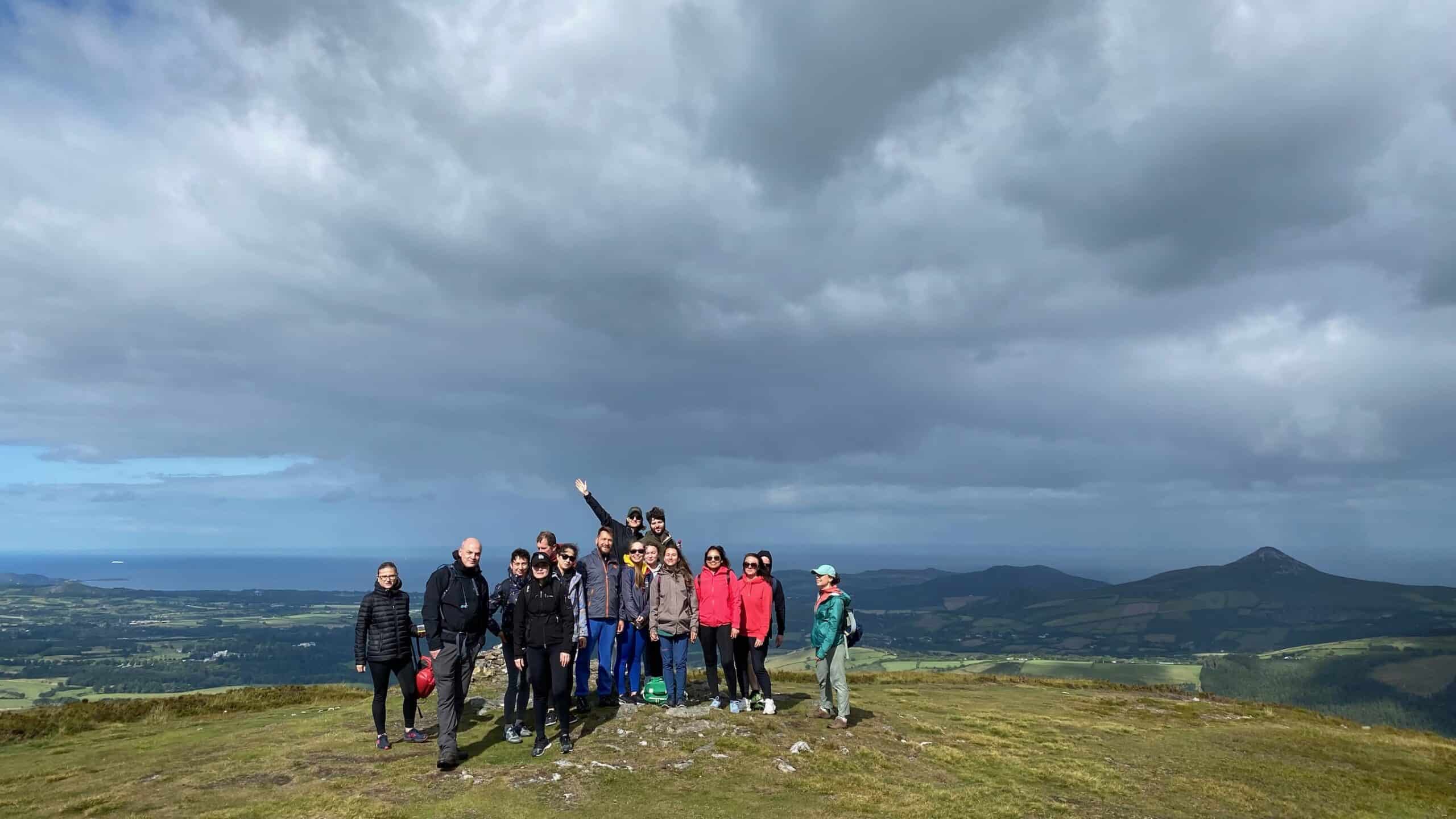
The Wicklow Mountains are a top destination for hiking in Ireland, providing stunning views and varied trails. For visitors based in Dublin, the Wicklow Mountains are the obvious first choice and they reward that choice every single time. The Wicklow Mountains National Park, covering over 20,000 hectares, is the largest national park in the Republic of Ireland, and it sits just 40 minutes south of the capital.
Whether you’re enjoying a peaceful hike or tackling a challenging trail, hiking in Ireland is an unforgettable experience. The landscape here was carved by glaciers during the last Ice Age. Deep U-shaped valleys, corrie lakes and broad, rounded summits define the terrain. The main spine of the mountains runs roughly north to south, with Lugnaquilla (at 925 metres, the highest peak in Leinster) anchoring the southern end.
The best single-day hiking experience in the park is the Glendalough Valley trail network. The monastic site at Glendalough, founded by St Kevin in the sixth century, sits at the junction of several excellent walking routes. The Green Road walk takes you along the north shore of the Upper Lake with views of the monastic ruins below. The Spinc Ridge walk is arguably the finest trail in the entire Wicklow Mountains, climbs steeply from the valley floor to a high boardwalk trail that offers panoramic views over both lakes and deep into the surrounding hills.
For those wanting longer routes, the Wicklow Way is Ireland’s oldest long-distance walking trail, running 130 kilometres from Marlay Park in south Dublin to the town of Clonegal in County Carlow. It passes through the heart of the national park, crosses the open bog plateau of the Sally Gap and Liffey Head, and descends through some of the most remote and beautiful terrain in the country. A perfect trail for hiking in Ireland.
Folklore note: The hills around Glendalough are associated not only with St Kevin but with older, stranger presences. Local legend holds that a fairy king known as Fionnbarra rules the hollow hills above the Upper Lake, and that on certain nights, the sound of music can be heard rising from the water. Whether you believe in fairy kings or not, there is something about the mist-hung quality of a Wicklow evening that makes such stories feel entirely plausible.
2. The Kerry Way and the Iveragh Peninsula
The Kerry Way is widely considered Ireland’s finest long-distance walking route. Stretching 214 kilometres around the Iveragh Peninsula (the same finger of land that the Ring of Kerry road follows by car) it climbs through mountain passes, skirts the shores of Lough Caragh, passes through the MacGillycuddy’s Reeks (home to Carrauntoohil, Ireland’s highest peak at 1,038 metres), and circles back to Killarney through landscapes of extraordinary beauty.
The route typically takes eight to ten days to complete in full, but individual sections can be walked as day hikes. The stretch from Killarney to Kenmare via the Black Valley is especially impressive: a remote glacial valley that had no mains electricity until 1976 and retains a quality of profound quietness that is increasingly hard to find anywhere.
Carrauntoohil itself, accessed via the Devil’s Ladder or the Caher Ridge, is a serious mountain route requiring good navigation skills and appropriate gear. It is worth every step. From the summit cross erected in 1950 and replaced several times since due to storm damage, the views on a clear day extend south to the Beara Peninsula, north across County Clare, and west across the Atlantic towards America.
Historical note: The MacGillycuddy’s Reeks take their name from the Mac Giolla Chuda family, who were chieftains of this territory in medieval times. The area was also a stronghold of the Gaelic order long after it had collapsed elsewhere, partly because of its sheer inaccessibility. When surveyors for the first Ordnance Survey of Ireland reached these mountains in the 1820s, they found communities speaking Irish as their first language and navigating the landscape by systems of naming and storytelling that went back centuries.
3. The Burren and the Cliffs of Moher Coastal Walk
County Clare’s Burren is one of the most distinctive landscapes in Ireland and one of the most remarkable in Europe. A vast plateau of exposed Carboniferous limestone, the Burren covers roughly 250 square kilometres and supports a flora of extraordinary diversity – Arctic, Alpine and Mediterranean species growing side by side in the cracks and fissures of the rock, in a phenomenon botanists have been trying to explain ever since they first documented it.
The Burren Way covers 123 kilometres through this strange, luminous landscape, passing stone forts, megalithic tombs, holy wells, medieval churches, and village settlements that have been here since the Bronze Age.

The 5,000-year-old Poulnabrone Dolmen, a portal tomb that was excavated in the 1980s and found to contain the remains of at least 33 individuals, is one of the most photographed prehistoric monuments in Ireland, and rightly so. Standing beside it in the early morning light, before the coaches arrive, is a genuinely moving experience.
The Cliffs of Moher Coastal Walk connects the Burren to the Atlantic with 14 kilometres of cliff-edge trail between Doolin and Liscannor. The cliffs reach 214 metres at their highest point. On a clear day, the Aran Islands are visible to the west, the Twelve Bens of Connemara on the northern horizon.
Folklore note: The cliffs are associated in local tradition with Morrigan, the shape-shifting goddess of war and fate in Irish mythology, who was said to appear as a crow on cliff-edges before battles. Whether or not you feel her presence, there is something undeniably primal about standing on the edge of a continent with the Atlantic booming below.
Each trail tells a story, and hiking in Ireland allows you to discover these tales firsthand.
4. Connemara: Bogs, Lakes, and the Twelve Bens

Connemara, in the west of County Galway, is the Ireland of the imagination – the place people picture when they think of wild Atlantic light, Irish-speaking communities, and a landscape that seems barely touched by the modern world. The Diamond Hill loop trail within the park is one of the most accessible and rewarding short hikes in Connacht – two to three hours, with views across the Atlantic from the summit.
For experienced hillwalkers, the Twelve Bens circuit is a full-day undertaking that covers multiple peaks and crosses some of the most remote terrain in Ireland. Route-finding skills and appropriate gear are essential; these mountains attract cloud and rain with determination.
The broader Connemara landscape, with its networks of bog roads, tidal inlets, and abandoned famine-era settlements – is perfect for gentler walking too. The Sky Road above Clifden, the Roundstone Bog, and the shores of Lough Corrib all offer routes that are more about atmosphere than elevation.
What to Expect: Practical Advice for Walkers
The Irish Weather

There is no polite way to say this: Ireland’s weather is unpredictable, and that is part of its character. Rain can arrive on a clear morning without much warning. Mist descends on mountain summits that were perfectly clear an hour before. The light changes constantly and dramatically.
The good news is that Irish weather is rarely extreme. Snow is uncommon except at higher elevations in winter. Temperatures are mild year-round, rarely dropping below zero at lower altitudes and rarely exceeding 20°C even in July. A good waterproof jacket, walking boots or cycling gear designed for wet conditions, and a willingness to embrace whatever the sky is doing are the main requirements.
The best months for hiking and cycling are May, June, September, and early October. July and August bring the longest days and the warmest temperatures but also the largest crowds on popular routes. Spring and early autumn offer quieter trails, often better light for photography, and the particular pleasure of having a wild landscape almost to yourself.
Leave No Trace
Ireland’s walking and cycling trails cross a mix of public and private land. The Leave No Trace principles apply throughout: take all litter with you, stay on marked trails where they exist, close gates behind you, and respect the land and the people who manage it. The wild beauty of Ireland’s landscapes is not accidental, it is the result of generations of careful land management, and it deserves the same care from visitors.
FAQ
What is the best time of year to go hiking in Ireland?
May, June, September, and early October offer the best combination of good weather, manageable crowds, and long daylight hours. Summer (July and August) is warmer and the days are longest, but popular trails like Glendalough and the Cliffs of Moher can be very busy. Spring and autumn bring quieter conditions and often more dramatic light. Winter hiking is possible on lower-level routes, but mountain trails require extra care and preparation.
Do I need special equipment for hiking in Ireland?
For low-level and coastal walks, comfortable walking shoes and a waterproof jacket are sufficient. For mountain trails (particularly in Wicklow, Kerry, and Connemara) proper waterproof hiking boots, a warm layer, a map or GPS device, and waterproof trousers are strongly recommended. Ireland’s mountain weather can change quickly, and exposed ridges can be significantly colder and wetter than the valleys below. A good rule of thumb: pack for rain, hope for sunshine, and you will never be caught out.

Leave a Reply